Hithadhoo (Hithadhoo)
Hithadhoo (Dhivehi: ހިތަދޫ) is a district of Addu City, in the Maldives. Hithadhoo is the main administrative district of Addu City, with many of the administrative buildings in this district. The town is situated on the island of the same name, the westernmost of Addu Atoll (previously known as Seenu Atoll). In terms of population count, Hithadhoo is home to the largest population in Addu City. According to the 2014 Census, with 11,129 residents, Hithadhoo also has the largest population of any administrative island in Maldives, a category that excludes the much larger national capital, Malé.
The island is 531.12 km south of the country's capital, Malé. Hithadhoo is the second largest island in the Maldives, with a surface area of 540 ha. It has a length of 6.8 km and a width of 1.8 km at its widest point.
The part of the island south of the town is lushly vegetated with palms and shrubs, whilst the northern end of the island consists of a partially stony, unreal scrubland, which can be explored only on narrow trails. Hithadhoo Town is marked by dusty roads, narrow lanes, leaning houses and dense vegetation. Island traffic is generally quite colourful, particularly when hundreds of island school children dressed in a multitude of differently coloured school uniforms are queueing up for the bus.
Map - Hithadhoo (Hithadhoo)
Map


Country - Maldives
 |
 |
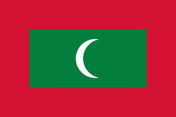
| Flag of Maldives | |
Comprising a territory spanning roughly 90,000 km2 including the sea, land area of all the islands comprises 298 km2, the Maldives is one of the world's most geographically dispersed sovereign states and the smallest Asian country as well as one of the smallest Muslim-majority countries by land area and, with around 557,751 inhabitants, the 2nd least populous country in Asia. Malé is the capital and the most populated city, traditionally called the "King's Island" where the ancient royal dynasties ruled for its central location.
Currency / Language
| ISO | Currency | Symbol | Significant figures |
|---|---|---|---|
| MVR | Maldivian rufiyaa | Þƒ | 2 |
| ISO | Language |
|---|---|
| DV | Dhivehi language |
| EN | English language |